| Last Update: March 15, 2015 |
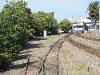
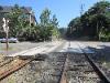
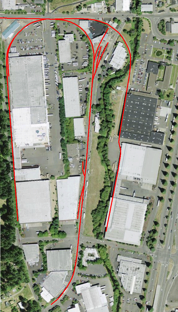
| This map shows the current operational line of the Oregon Pacific Railroad, East Portland Line. The branch line starts at the UP/OPR interchange in East Portland and continues south to the Milwaukie Industrial Park where most of the OPR's customers are located. The OPR shops are also located within this area. The track follows along the Willamette River and is flanked by the river on one side and scenic wetlands on the other side and is some of the most scenic inner city track in the country. On right are profile maps of the East Portland Division, including the now abandoned Boring Branch of the Portland Traction Company. |
| History of the OPR - East Portland Branch - Molalla Branch - Videos of the OPR in Action News & Upcoming Events - Photos of Past Events - Roster of the OPR Special Features |

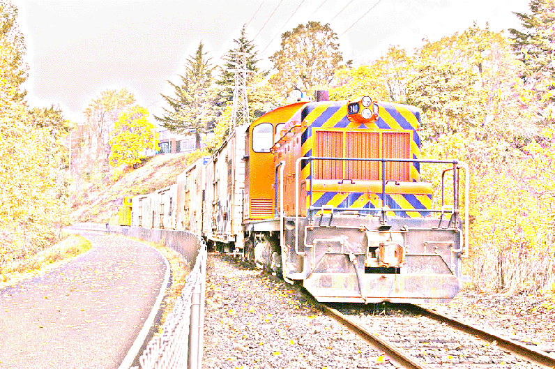
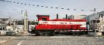
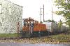
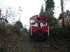
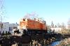
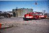
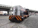
| OPR 100 Roster Page No. 100 is the most famous engine in the Northwest and has served on this line for more than half a century. Today it continues to serve in regular service. |

| History of the OPR - East Portland Branch - Molalla Branch - Videos of the OPR in Action News & Upcoming Events - Photos of Past Events - Roster of the OPR Special Features |
| Copyright � 2004-2015 All Rights Reserved |

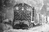
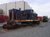
| OPR 802 Roster Page No. 802 is a former Southern Pacific switcher and the only OPR locomotive with dynamic brakes. It's currently undergoing a full restoration on the East Portland Branch. |

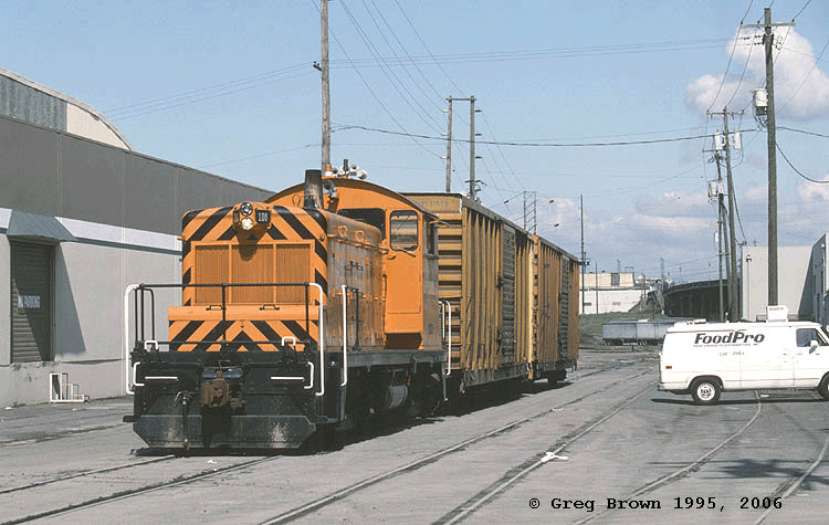
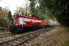
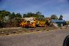
| OPR 1413 Roster Page No. 1413 is the newest locomotive in the OPR fleet, making 1275 h.p. its a fully rebuilt, Canadian heritage GMD-1 and the most powefull locomotive in the fleet. |
| EAST PORTLAND DIVISION of the OREGON PACIFIC RAILROAD |
| For a complete detailed history of the East Portland Branch when it was owned and operated by the Portland Traction Company and its predecessor railroads, with many included photos, please visit our... Portland Traction Company & PEPCo History Page |
| Locomotives Currently in Active Service on the East Portland Division |
| Maps of the East Portland Division |
| About the East Portland Division |
| The East Portland Division is one of two divisions of the Oregon Pacific Railroad. It was purchased by Richard Samuels in 1991 from the Portland Traction Company. The new company and railroad was originally named the East Portland Traction Company. In 1993, Mr. Samuels purchased the Southern Pacific Molalla Branch and renamed it the Molalla Western Railroad. He operated both railroads, but maintained seperate companies and names. In 1996, both companies were officially merged into the Oregon Pacific Railroad with the East Portland Traction Company becoming the East Portland Division of the OPR and the Molalla Western becoming the Molalla Branch Division of the OPR. The East Portland Division of the OPR is the remains of a vast network of interurban railroads that once encompassed the entire Portland Area. The remains comprises of approximately 5 miles of mainline track, with an interchange yard at the north end, that interchanges with the Union Pacific Railroad and an industrial park at the south end. The industrial park is where most customers are located as has been the case for this railroad going back into the Portland Traction Company days. The East Portland Branch starts at the UP East Portland Yards and runs in a southerly direction, where it runs along the Willamette River and through the Oaks Bottom Wildlife Refuge. It passes the Oaks Amusement Park, which is one of the oldest existing amusement parks in the U.S. and only Amusement Park in the Portland Area. It then continues through the quiet suburban neighborhoods of Sellwood, before reaching the industrial park in Milwaukie. The grade into the industrial park comprises of a rare and steep 6% grade with crossings at the top and middle of the hill and 2 switches in the middle of the hill. From the middle of the hill to the bottom of the hill are two separate spurs that are both on a tight curve. All of this makes for challenging railroading that requires a good bit of skill and experience to operate. The East Portland Divisionis the only OPR division that operates passenger trains. Currently the Molalla Branch Division with its excepted track cannot legally operate passenger trains. However, the East Portland Divsion has Class 1 track designation from approximately Golf Junction to the East Portland Yards where passenger trains can legally and safely operate. Passenger trains comprise of OPR private charters and an annual steam locomotive event put on by ORHF every December called the Holiday Express. The majority of freight business comes from the Milwaukie Industrial park and comprises mostly of both inbound and outbound cold food storage. The majority of freight cars currently used on the line are refrigerator cars. However, in the past, the line has supported everything from paper products to alcoholic beverage shipments. The north end of the line has one new customer, as ORHF built a new steam locomotive interpretive center next to the OPR East Portland yards and interchanges with the OPR. |


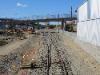
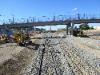
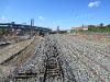
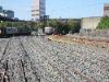
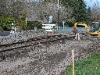
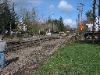
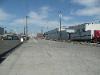
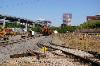
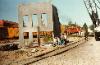
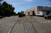
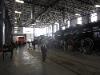
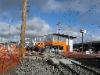
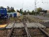
| The East Portland Yard of the OPR has undergone numerous extensive changes over the years. Built in the late 1800s, it was the center of Portland Traction and predecessor railroad operations on the east side of Portland for over 100 years. The Portland Traction and Pepco shops were located here, although the East side operation trolleys were originally stored and maintained at the trolley barn located at Golf Junction. The East Portland Yards was the interchange point for numerous industries in the general area. A maze of tracks took off to industries both north and south of the yards. Much of this track was in street, accessing dozens of warehouses along water street. In the last years of trolley operations through 1991, the Portland Traction Company maintained its main shops and facilities here. When the Mr. Samuels took over the Portland Traction Company, he did not acquire the Portland Traction Shops and instead moved operations of the new railroad company to the Milwaukie Industrial Park on land that he already owned. Today, the main shops of the OPR is located there, closer to the customers on the line that sometimes need daily switching services. The East Portland Yards was the main interchange for the Southern Pacific Railroad (now owned and operated by the Union Pacific Railroad). The numerous tracks that used to be located here were used for sorting cars from the various Portland Traction branch lines, before they were interchanged with the SP. The first major change for the East Portland Yards came in the early 1960s when it was anticipated that a new freeway called the Mt. Hood Freeway would be constructed. An off ramp was to be constructed from the I-5 Marquam Bridge, just north of the yard and fly over the PTC yard. The yard had to be relocated to allow for construction of pillars for new off ramp. As it turned out the yard was moved, but the off ramp and the freeway were never built. After the sale of the PTC property to Mr. Samuels, much of the existing yard was not needed due to reduced traffic. A lot of track was moved and only the tracks deemed necessary was left. Several major changed occurred under OPR ownership as new track was constructed for a major SamTrak station and platform. That track and platform was removed several years after SamTrak ceased operations in 2002. In 2011, the City of Portland constructed an overpass over the East Portland yards for it's Portland Streetcar system that would eventually meet up with the new Milwaukie Light Rail system. 2012 would bring the largest change to the yard in recent decades as the entire existing OPR East Portland yard was removed, rebuilt and relocated as part of the Milwaukie Max Light Rail project. With the Light Rail passing over the OPR tracks almost directly in the middle of the existing yard, the OPR yard had to relocated and rebuilt further north so that the Light Rail would only have to cross a single mainline track and the OPR could switch cars inside the new yard north of the Light Rail crossing. The construction project took place in the spring and summer of 2012 with the new Light Rail line expected to be completed by 2015. Today, the new OPR yard has one run through track, 5 storage spur tracks, one of which is leased to office cars permanently stored on the spur and two run around tracks. Traffic is interchanged with the Union Pacific nightly, on the main run through track that connects with the UP. Prior to the 2012 rebuild the OPR had two UP interchange tracks. A north and south leg, giving the OPR two separate tracks on which it could leave or pick up cars. Because only one interchange track is needed, the south leg interchange was removed. One industry track, the ORHF complex, interchanges with the OPR at the yard. |
| Map of the yard as it was laid out of as Summer, 2008. The blue track is the Union Pacific double track mainline. The red track is the OPR interchange, yard and mainline heading south towards Milwaukie. This all changed in 2012. |
| East Portland Yards - Begin at OPR/UP Interchange Switch PEPCo MP prior to 1955: X.XX - PTRD MP after 1955 (FRA): 0.12 - OPR Current MP: 0.00 |

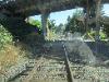
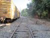
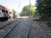
| Some photos of the East Portland Yard under Portland Traction ownership, taken from the late 1970s through the mid 1980s. |


| A view of the East Portland Yards from a northbound OPR locomotive in 2011 prior to reconstruction. From the south end of the yard to the north end. |
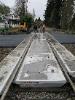
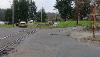
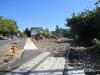
| On Official Portland Traction Maps from 1970, the "Beginning of Main Line" (headed south) is noted as being just north Caruthers Street where the most southern switch of the original yard was located. When the OPR yard was relocated further north, the beginning of mainline changed further to just south of the Milwaukie Light Rail interlock. Just south of the former switch is Caruthers Street, one of only two crossings protected by crossing gates on the East Portland Division. The gates were installed in the 1990s and prior to that it was an unprotected crossing. From this crossing to Ivon St used to be all paved and was in street track with several industrial spurs. This all changed between 2005-2007, when OPR crews tore out the paved crossings and industrial track at the request of the City of Portland because of a construction project they were working on. The in street trackage and industrial spurs were no longer needed, although the OPR did store equipment on the spurs. The new conventional track is safer for both the railroad and vehicles as it prevents vehicles from parking on and blocking the tracks. See below for more info and photos. The Caruthers street crossing was replaced and improved with concrete panels and new crossing signals in 1996. Through the mid 1990s, the Southern Pacific had a spur line that ran right down the middle of Caruther's Street, east-west to Lone Star Concrete. The spur crossed the Portland Traction Company line. It's interesting to note that the PTC never built a spur into this complex. The reasoning behind his was that years prior to the SP gaining partial ownership over the PTC, the SP competed with the PTC for some of the industrial water front business in the area, including a huge mill that used to exist here. This spur was likely the remains of that track. |
| Photo Tour of the East Portland Division from East Portland Yards to Milwaukie Industrial Park & End of Track |
| Note about Mileposts on the East Portland Division Official Mileposts on the East Portland Division have changed over the years, because milepost 0.0 was originally located at SW 1st and Washington, in the early PEPCo Trolley days. By the mid 1950s just prior to trolley service ending, the beginning of the line was cut back to SE 1st and Hawthorne just north of the Portland Traction Company East Portland Yards. This shifted mileage somewhat along the entire line south. The official FRA mileage markers as noted for crossings is based on SE 1st and Hawthorne being MP 0.0. These are still the mile markers used by the FRA today. However they no longer refect the true mileage of the line as it exists today with the northern most point being the current OPR/UP interchange switch. Below you will see all three mileage points for all historical stations. All other stations, sidings and crossings and other points of interest will reflect FRA mileage points as well as current actual mileage points. |
| Beginning of Main Line - Caruthers Street Crossing PEPCo MP prior to 1955: X.XX - PTRD MP after 1955 (FRA): 0.49 - OPR Current MP: 0.37 |
| Milwaukie Light Railroad at Grade Crossing & Interlocking Plant PEPCo MP prior to 1955: X.XX - PTRD MP after 1955 (FRA): X.XX - OPR Current MP: X.XX (not in service yet) |
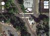
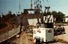
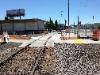
| This is the location of the now operational Milwaukie Light Railroad / OPR crossing. It is one of only a few at grade crossings of a common carrier railroad and a light rail transit system. The at grade crossing was deemed necessary because the only alternative was to go over the OPR line with a bridge, but this would require a prohibitively steep grade to reach the nearby Willamette River Light Rail bridge and make it impossible to have a major station near OMSI as planned. The at grade crossing required that the entire existing OPR East Portland Yard be removed and relocated further north to near the original location of the Portland Traction Company's East Portland Yards. The new OPR was constructed in the spring and summer of 2012. The at grade crossing also required at the OPR mainline be severed from it's new East Portland Yards via an interlocking switch that was normally set for the Max Light Rail to run through the crossing unimpeded. When OPR trains need to enter the East Portland Yards, they are required to give 15 minute notification to the Light Rail Dispatcher. Upon which OPR crews will punch in a code to lock out the Max Line and line the derails and allow the OPR train through. The same procedures apply for the southbound move back to Milwaukie. The interlocking switch is protected by signals on both railroads and a power derail on the OPR mainline. |
| Division Street Crossing & Former Industrial Track PEPCo MP prior to 1955: X.XX - PTRD MP after 1955 (FRA): 0.56 - OPR Current MP: 0.44 |
| Ivon Street Crossing & Former Industrial Track FRA milepost 0. -- PEPCo milepost |
| The Division Street Crossing is an unprotected crossing. The crossing used to get very little traffic, but today with the new Hwy 99E on ramp just to the east, traffic has increased. Two industrial spurs used to leave the railroad at Division Street. The former Inman-Poulson Lumber Mill spur left the west track, paralleling north, before curving south into the mill, prior to reaching Caruthers Street. This track remained long after the mill was closed and torn down in the mid 1950s and was in service through the 1980s. Today, the connection to the main railroad is gone. Part of the spur still remains isolated in the pavement on property that was formerly used by the mill, but owned by another business. Another industrial spur left the east track, also paralleling north for about 224 feet. This spur remained visible until the area was reconstructed in 2005-2007. |
| The Ivon Street Crossing is an unprotected crossing. The crossing used to get very little traffic, but today with the new Hwy 99E on ramp just to the east, traffic has increased. Ivon Street is the last crossing in East Portland prior to the railroad following the Willamette River into Sellwood. Two industrial spurs left the railroad at Ivon St. From the east track, a 400 foot long spur left the railroad and headed north paralleling the tracks. From the west track, a 328 foot long spur left the west track and headed north paraelling the tracks. Both spurs were still visible as late as 2005, but were removed or paved over when the city reconstructed the streets in the area in 2007. They used to serve several warehouses on Water Ave. |
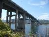
| Ross Island Highway Bridge PEPCo MP prior to 1955: X.XX - PTRD MP after 1955 (FRA): 0.80 - OPR Current MP: 0.68 |
| Bundy Spur (historical) PEPCo MP prior to 1955: X.XX - PTRD MP after 1955 (FRA): X.XX - OPR Current MP: X.XX |
| Eastern & Western Logging Company Log Dump (historical) PEPCo MP prior to 1955: X.XX - PTRD MP after 1955 (FRA): X.XX - OPR Current MP: X.XX |
| Riverside Station (new) PEPCo MP prior to 1955: X.XX - PTRD MP after 1955 (FRA): 0.97 - OPR Current MP: 0.85 |
| Ross Island Sand & Gravel Spur PEPCo MP prior to 1955: X.XX - PTRD MP after 1955 (FRA): 1.33 - OPR Current MP: 1.21 |
| Holgate Moorage House Boat Community (historical) PEPCo MP prior to 1955: X.XX - PTRD MP after 1955 (FRA): X.XX - OPR Current MP: X.XX |
| Holgate Curve - Begin North End PEPCo MP prior to 1955: X.XX - PTRD MP after 1955 (FRA): X.XX - OPR Current MP: X.XX |
| North Bridge PEPCo MP prior to 1955: X.XX - PTRD MP after 1955 (FRA): 2.40 - OPR Current MP: 2.28 |
| The Oaks Station (Oaks Amusement Park) PEPCo MP prior to 1955: 3.92 - PTRD MP after 1955 (FRA): 3.09 - OPR Current MP: 2.97 |
| South Bridge PEPCo MP prior to 1955: 0.00 - PTRD MP after 1955 (FRA): 3.11 - OPR Current MP: 2.99 |
| Chutes (historical) PEPCo MP prior to 1955: 4.14 - PTRD MP after 1955 (FRA): 3.31 - OPR Current MP: 3.19 |
| Spokane Street (Ferry Station historical) PEPCo MP prior to 1955: 4.41 - PTRD MP after 1955 (FRA): 3.58 - OPR Current MP: 3.46 |
| Sellwood Highway Bridge Overpass PEPCo MP prior to 1955: X.XX - PTRD MP after 1955 (FRA): 3.64 - OPR Current MP: 3.52 |
| Umatilla Street Crossing PEPCo MP prior to 1955: X.XX - PTRD MP after 1955 (FRA): 3.70 - OPR Current MP: 3.58 |
| Harney Steet Crossing (Station historical) PEPCo MP prior to 1955: X.XX - PTRD MP after 1955 (FRA): 3.80 - OPR Current MP: 3.68 |
| Linn and 9th Street Crossing PEPCo MP prior to 1955: X.XX - PTRD MP after 1955 (FRA): 4.05 - OPR Current MP: 3.93 |
| 11th Street Crossing PEPCo MP prior to 1955: X.XX - PTRD MP after 1955 (FRA): 4.16 - OPR Current MP: 4.04 |
| 11th Street Crossover Switch and Siding PEPCo MP prior to 1955: X.XX - PTRD MP after 1955 (FRA): X.XX - OPR Current MP: X.XX (not in service yet) |
| Golf Junction PEPCo MP prior to 1955: 5.02 - PTRD MP after 1955 (FRA): X.XX - OPR Current MP: X.XX |
| 13th Street Crossing PEPCo MP prior to 1955: X.XX - PTRD MP after 1955 (FRA): 4.26 - OPR Current MP: 4.14 |
| "The Pass" & Siding PEPCo MP prior to 1955: X.XX - PTRD MP after 1955 (FRA): 4.26 - OPR Current MP: 4.14 |
| 17th Street Crossing PEPCo MP prior to 1955: X.XX - PTRD MP after 1955 (FRA): 4.26 - OPR Current MP: 4.14 |
| Helico Spur (Milwaukie Industrial Park) PEPCo MP prior to 1955: X.XX - PTRD MP after 1955 (FRA): 4.26 - OPR Current MP: 4.14 |
| AmeriCold Spur (Milwaukie Industrial Park) PEPCo MP prior to 1955: X.XX - PTRD MP after 1955 (FRA): X.XX - OPR Current MP: X.XX |
| McBrod Ave Spur to OPR Shops (Milwaukie Industrial Park) PEPCo MP prior to 1955: X.XX - PTRD MP after 1955 (FRA): X.XX - OPR Current MP: X.XX |
| OPR Shops and Milwaukie Yards PEPCo MP prior to 1955: X.XX - PTRD MP after 1955 (FRA): X.XX - OPR Current MP: X.XX |
| McBrod Ave Spur from OPR Shops to End of Track PEPCo MP prior to 1955: X.XX - PTRD MP after 1955 (FRA): X.XX - OPR Current MP: X.XX |
| Photos of the newly constructed OPR yard. These are north facing photos of the north end of the yard, where most of the yard track now resides. The yard is now mostly finished, with all track laid and ballasted and in usable condition. The only tasks remaining are final surfacing and lining, which should be completed by mid September. |
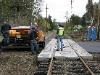
| Right photo shows the Caruthers Street crossing looking west as viewed from the new MLK Viaduct. Middle Photo by Scott Anderson in the Spring of 2012 shows the OPR 1202 crossing Caruthers street with the crossing gates down. Right photo is looking north towards the Caruthers street crossing from just north of the Division Street crossing. |

| Left photo shows the Division Street Crossing looking west as viewed from the new MLK Viaduct. Middle Photo taken in Sept, 2011, showing the 1202 with a passenger train just south of the Division Street Crossing (behind the caboose) Right photo was taken 2004 prior to the 2005 reconstruction of the crossing, showing the Division Street Crossing and the remains of the eastern industrial spur mentioned above. These remains are now gone. |


| First two photos on the right show the 1202 and a passenger train stopped near Ivon Street. Ivon Street is also the beginning of the Springwater Trail. Two middle photos were taken in 2004 and show the former 4501 set out on an industrial spur. The last 1993 photo shows No. 100 southbound at Ivon Street with both east and west industrial spurs still active with an east and west mainline track. Today, all of these industrial spurs and have been removed and only a single mainline track is left. |
| Two sections of the Ross Island Bridge now pass over the OPR East Portland Division. The main section of the bridge was built in 1926. An artery connection from the bridge to Highway 99E was constructed in the early 1960s, causing essentially another bridge to pass over the railroad. |
| Riverside Station is a brand new stop on the OPR, having been added in approximately 2009 as an occasional stop for excursion trains operating on the OPR. Riverside station is located just south of the Ross Island Bridge next to where the City of Portland has located several picnic tables on a wide grassy area next to the river. The OPR has installed a gate at this location allowing passengers to exit the train and enjoy the picnic area on the other side of the railroad fence. Currently this station is not marked, except for on our time tables. This area is what used to be known as Bundy Spur (see below) and the old spur is now converted to a dirt trail and the remaining wide area and log dump, a grassy park. |

| These photos from 2009 show an OPR chartered passenger train stopped at the new Riverside Station while passengers disembark and enjoy the park setting. |
| Bundy Spur was a major spur located on the Portland Traction Company line. It left the west track just south of the Ross Island bridge and parellelled the PTC headed south for 1386 feet before joining back up with the PTC line. In the middle of the spur, a large hoist and cable tower that at one point crossed the river to the west side, existed. This part of the Willamette River was called Holgate Slough and was used as a large log dump and the hoist may have been a log hoist. We aren�t sure the when the spur and hoist ceased being used, the track was removed around 1962. The Portland Traction Company removed the switch at some point to prior to 1962, when the switch was left in the wrong position causing a train to derail. |
| This photo was taken from the Ross Island Bridge (before the 99E off ramp was constructed) sometime in the 1950s, looking south. Bundy Spur is the spur taking off to the right. In this photo, the spur looks fairly disused by this time. Also there is no evidence of a large hoist in the background, leading us to believe it was disassembled by then. There is a large pile of ties in this photo next to the beginning of the spur leading us to wonder if maybe part of the spur had already been picked up at this point. |


| The Eastern & Western Logging Company operated a mill in Portland in the 1920s, located near 21st street. In 1925, the E&W constructed a 21 mile plus logging railroad out of Molalla into the woods. This logging railroad connected with the Willamette Valley Southern, which brought logs into Portland. Those logs were interchanged with the Southern Pacific and then onto the PEPCo line that is now the OPR. The logs were dumped into the Willamette River south of the Bundy Spur, then floated upstream to the Eastern and Western Mill. It�s not clear how long this log dump lasted. The E&W holdings were burned in the late 1920s by a large forest fire, although salvage operations continued into the 1930s. The Log Dump may have been used by others in later years, but it was always known as the Eastern & Western Log Dump on time tables. The spur and track was salvaged around 1962. |
| All industrial spurs and 2nd mainline track being removed from Water Ave near Ivon Street in 2006 and 2007. When finished only one mainline track would remain in service today. |

| Rebuilding the Division Street Crossing in 2005. The first photo is from the Ivon Street Crossing, looking north. The Ivon Street crossing all the associated spurs would be removed and rebuilt a few years later. See below |


| Photo on left appears to date after 1937 when the Grand Ave Viaduct (background) was built, shows a southbound trolley crossing what was Division Street back then. Middle photo was taken in the late 1980s while still under Portland Traction ownership. Photo on right was taken from approximately the same angle and area in 2012. |


| Ross Island Sand & Gravel has been located in its current location for decades, having direct access to it's Ross Island operations. Today a spur still exists into Ross Island Sand & Gravel, but currently nothing is shipped on it. Instead, the OPR occasionally stores MoW equipment on the spur. The spur has existed, probably since at least the 1940s. However, the spur isn't shown on our 1970 PTC maps for some reason. |
| A now defunct community use to exist here called Holgate Moorage. On time tables, it was simply called "Moorage". It was located just south of the current Ross Island boat ramp crossing and prior to the start of Holgate Curve. Census records indicate that people used to live in here on houseboats as early as the 1920s. At one point a separate road and stairwell existed to access the house boats and a trolley stop must have existed here. A 5 car garage and parking existed next to the tracks for houseboat owners. However by the 1950s it was no longer a regular stop and the floods of 1964 wiped out much of the area, sending the entire remaining houseboat fleet crashing into bridge down river. The houseboat moorage was never rebuilt. When the Holgate "jughandle" was built on the hillside above the tracks to allow southbound McLoughlin Blvd traffic to easily access Holgate Blvd, the new fill buried most remains of the old access road and parking lot. Almost no hint of Holegate Moorage exists today although we believe some remnants of the old road can be seen as well as a few pilings sticking out of the water. |
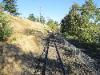
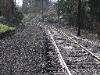
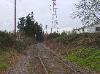
| Holegate Curve is a 2000 foot long curve built into the line to compensate for a bend in the Willamette River. The curve carries the tracks inland slightly away from the river. Running the curve offers a good view to the back at the train, which is particularly enjoyable for riders on the longer Holiday Express Steam trains. This curve has presented challenges to the OPR when operating large steam engines on track not originally designed for them and was the site of several derailments in the mid 2000s. However, extensive work by the OPR in upgrading the track well beyond what is need for normal freight service has alleviated these problems for now. |
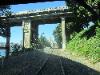
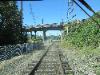
| North Bridge refers to one of two small steel bridges that were built by the OPR in 2003 as part of the relocation of the OPR right of way and the building of the Springwater trail. In the early 2000s and prior, the OPR operated on the western right of way, just as the Portland Traction Co. had for years before. However, Metro and the City of Portland wanted to use the western right of way, closer to the river for the Springwater Trail. The OPR agreed to relocate its track back to the eastern right of way, which had not been used in decades. As part of this trail system, Metro wanted two pedestrian under passes to be constructed that would allow pedestrians to cross under the railroad to access public lands. The first underpass was located at what is now called North Bridge, just south of Holegate Curve. Here a steel bridge passes over a newly constructed paved bike trail system that leads off of Milwaukie Ave and down into Oaks Bottom, connecting with the Springwater trail on the west side of the tracks. See �South Bridge� for information on the 2nd underpass. |
| The Oaks Station is a major station point on the OPR�s East Portland Division. It is the center point of all passenger operations. The Oaks Station was originally established in 1905 as a station point on the line for the new constructed Oaks Amusement Park. Oaks Amusement Park remains today, although passenger trolleys ceased running to it prior to 1957 and the station was not used again until revived by the OPR in the mid 1990s. At that time, the OPR�s SamTrak operation established what would be called Oaks Park Station. The OPR changed the name of Oaks Park Station back to the original �Oaks� station for historical purposes in 2011. From 1905 until sometime in the 1950s, there was a baloon that took off from The Oaks and ran down into the Oaks Amusement Park. The track then allowed trolleys to return back to the mainline as quickly as possible without having to reverse direction. That track is long gone, although part of it was used to display the historic Portland owned steam engines, SP 4449, SP&S 700 and O&RN 197 from the 1950s through the 1980s. In 2003, when the entire line from Ivon Street to Spokane Street was shifted from the west right of way to the east right of way, the OPR left some west track in place at Oaks Station on the west right of way to create a storage spur, which is used on a regular basis. At Oaks Station all OPR passenger related operations begin and end, with passengers able to park in the Oaks Amusement Park parking lot and easily board trains. The Portland Traction Trolleys may have ceased stopping at Oaks Park sometime after 1949 and before 1951 according to some time tables that we have. However, a board walk existed from Oaks Amusement Park to the mainline through at least the 1970s. |
| South Bridge refers to one of two small steel bridges that were built by the OPR in 2003 as part of the relocation of the OPR right of way and the building of the Springwater trail. In the early 2000s and prior, the OPR operated on the western right of way, just as the Portland Traction Co. had for years before. However, Metro and the City of Portland wanted to use the western right of way, closer to the river for the Springwater Trail. The OPR agreed to relocate its track back to the eastern right of way, which had not been used in decades. As part of this trail system, Metro wanted two pedestrian under passes to be constructed that would allow pedestrians to cross under the railroad to access public lands. The first underpass was located at what is now called North Bridge, just south of Holegate Curve. The second bridge, called South Bridge, is located directly south of Oaks Station. It allows pedestrians to access the Oaks Bottom meadow and a dirt trail system from the east side of the tracks to the west side of the tracks. |
| The Chutes Station is located south of the Oaks Station. It was also a trolley stop through around 1951. Not a regular stop, but possibly a flag stop for local service. Chutes refers to an early days amusement ride at Oaks Park located near the station where was. On the ride, visitors would ride a car down a log chute into a pool of water. The station may have been where the loop track of the Oaks Park spur, reconnected with the mainline. However just the south of this connection based on 1918 maps, a spur took off from the mainline and split into 3 different tracks. We aren't sure what industries these tracks served, but "Chutes" could have been station point there these tracks left the mainline. Today nothing remains of the station or the former connection or tracks. The area where the industry tracks used to exist is now a city park with no hint of its former history. |
| Spokane Street Station was a stop located on the trolley lines just south of Spokane street. A small station shack was located on the southeast corner of Spokane Street and the railroad. It was a station stop until approximately 1951. The OPR rebuilt this crossing with all new track and concrete crossing panels and it�s much safer for motorists and trains alike. Prior to the 1925 construction of the Sellwood bridge, this stop was called Ferry, because Spokane street lead down to the Willamette River where a ferry existed that ferried people across the Willamette River. After the bridge was built the ferry was no longer needed. The ferry was then converted to a public boat ramp, but subsequently closed after too many cars were found driving down Spokane Street and into the river. The crossing is a relatively busy crossing, but is not protected by crossing gates. Most traffic through this crossing are customers of Oaks Amusement Park, but it also provides access to condos further west of the crossing and also to private house boats north of Oaks Park. Users of the Springwater trail, including bikers and pedestrians often leave the trail and cross this crossing to access Sellwood. |
| The Sellwood Bridge was built in 1925 and passes over the OPR tracks. Until recently the bridge has had little affect on the railroad. However, it was the site of a major scene filmed on the OPR for the TV show Leverage. A new bridge is currently under construction at this location. |
| The Umatilla Street crossing is another unprotected crossing on the OPR line. It�s a smaller crossing that only accesses a large condo complex on the Willamette River just south of the Sellwood bridge. Most of these condos will be demolished as part of the new Sellwood bridge project and the crossing gets very little use by cars as the condos are now largely abandoned and the entrance blocked off by a fence. However, pedestrians and bicylists do use the crossing. In 2008, the track in this area was shifted over to the east to make room for a large City of Portland Sewer pipe system. Once that project was finished the new wider right of way over the sewer system then became part of the Springwater trail extension. The OPR rebuilt this crossing with all new track and concrete crossing panels in 2008. Currently the paved portion of the Springwater trail ends here at Umatilla Street and continues on as a gravel trail that will eventually be paved later. |
| This is one of the longer unprotected crossings on the OPR�s East Portland Division. It�s an unusual crossing located at the intersection of 9th and Linn Streets. 9th street and Linn Street meet just to the east of the crossing and both streets connect and then cross the railroad as Linn Street. The challenge of this crossing is that traffic from the east approaches the crossings from two different directions and could both potentially use the crossing. The OPR rebuilt this crossing with all new track and concrete crossing panels and it�s much safer for motorists and trains alike. 9th and Linn was the location of an industrial spur whose remains were still visible until just a few years ago. A spur left the mainline in the middle of the crossing and headed north as in street track on 9th street. It then curved to the east on Marion St for a short distance. This spur was likely an original run around spur that accessed the 13th street trolly tracks. However, in later years, it served an industry located on Marion St. My 1980, the tracks were paved over. It's not clear when the tracks were last used. The curve to Marion Street was extremely sharp and may not have been suitable even for the SW1 diesels, so we aren't sure of it was in use when the SW1s came along in the early 1950s. |
| The Harney Street crossing is another unprotected crossing on the OPR line. It�s a smaller crossing that accesses a private marina and house boat dock. A trolley station existed here at one point. However time tables indicate this station was closed sometime prior to 1948. In 2008, the track in this area was shifted over to the east to make room for a large City of Portland Sewer pipe system. Once that project was finished the new wider right of way over the sewer system then became part of the Springwater trail extension. The OPR rebuilt this crossing in 2008 with all new track and concrete crossing panels. |
| Marion Steet Crossing PEPCo MP prior to 1955: X.XX - PTRD MP after 1955 (FRA): 3.98 - OPR Current MP: 3.86 |
| 11th Street Crossing is another unprotected crossing on the OPR�s East Portland Division. It only accesses several homes at the end of 11th street and on Waverly Country Club Rd, which joins back up with 9th street. The OPR rebuilt this crossing with all new track and concrete crossing panels and it�s much safer for motorists and trains alike. When rebuilt, the OPR added a second crossing panel track as future plans include rebuilding the former siding that existed here between 13th and Linn Streets. |
| The Marion Street Crossing is another unprotected crossing on the OPR. It accesses a large collection of condos along the Willamette River. In 2008, the track in this area was shifted over to the east to make room for a large City of Portland Sewer pipe system. Once that project was finished the new wider right of way over the sewer system then became part of the Springwater trail extension. The OPR rebuilt this crossing with all new track and concrete crossing panels in 2011. |
| "The Pass" is a section of track between 13th Street and 17th Street. The former street car double track went down to just one track north of 11th street, before becoming double track again south of 11th street. This double track south of 11th street remains in place today with one track (west side) being the OPR mainline while the other track (east side) is now a storage spur. Until 1991, the storage spur was the mainline that continued to Boring, while the current mainline was the industrial track lead that went to the Kellogg Industrial Park, now known as the Milwaukie Industrial Park where most of the OPR's current East Portland Division customers are located. This section of track has some of the oldest welded rail still in existence, having been welded in the 1950s by Portland Traction crews who used the over head traction wires for power. Until recently, the track and ties in this section were the most original of the entire division and it was in the poorest condition. OPR crews have since begun to replace numerous ties in the pass and some sections of rail, while trying to maintain the original welded rail for nolgstala purposes. The future of this historical section of track is uncertain. The Springwater trail was originally planned to follow the entire East Portland Division from East Portland to 17th Street on one of the double track right of ways and then continue along the former Boring Branch. The OPR has granted most of these plans, with the trail now extending from East Portland to nearly 13 street. However, the OPR has been resisting plans to extend the trail through 11th street and down the pass where the siding would have to be removed, leaving the OPR with only one mainline track and no car storage space as well as altering this historic section of track forever. |
| In 2011, the OPR began to construct what will become a new siding from 13th Street to Linn Street. This siding used to exist years ago, but was later removed by the Portland Traction Company. It may have been in place as recently as 1980. A siding was left in place from approximately 13th street to 11th Street. However, that siding is not long enough for the OPR�s needs. So the current 13th street siding is being extended down to Linn St and a crossover switch is being installed between 11th and 13th streets that will allow trains to access the siding from the south end. If a north end connection is installed, the siding will be the first run around track south of the East Portland Yards that the OPR East Portland Division has had for years. |
| The Oregon City Junction Spur is the current remains of the former Oregon City Junction and Oregon City Division line that was constructed in 1893 and abandoned in 1968. By the late 1960s, most businesses along the Oregon City Division Branch were gone except for a large paper mill. But the paper mill could be served from the SP mainline, so the Oregon City Div was no longer needed. The tracks were removed except for the first several hundred of the line, which remain today as this spur. The spur can hold up to 2 or 3 cars, however its not in regular use by the OPR. |
| The 17th Street Crossing is the busiest crossing on the OPR's East Portland Division and one of only two protected crossings on the Division. The crossing originally had three crossing gates, including one each to protect both sides of the 17th street and one crossing guard on Ochoco St to prevent traffic from making a left hand turn onto the railroad tracks. However, the Ochoco St gate is redundant and was recently damaged by a vehicle. Another major feature of the 17th street crossing is the change in grade. 17th street marks the beginning of the extremely steep 6% downhill grade into the Milwaukie Industrial Park. As trains crest over 17th street, knuckles clatter as the train bends over to decent the hill. The 6% grade is one of the most challenging parts of operating on the OPR and requires skill and experience to negotiate. |
| XX |
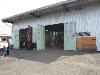
| The Heleco Spur is located in between the OPR shops and 17th Street and is named for the Heleco Distribution Center that it serves. Goodwill is a major tenant of the complex and has only been here since 2004 but unfortunately does not ship over the railroad, despite occupying a large portion of the industrial complex this spur was built to serve. Food Services of America occupied the space that is now used by Goodwill and was a major shipper on the OPR until they relocated to Woodburn. Several other shippers have also relocated from the complex over the last few years. Today, no shippers exist with the last shipper being J&D Refrigerated Services, which had to move when the Milwaulkie Light Rail project forced them to relocate another related facility. The spur is very much serviceable and it's hoped another customer will soon take over. This spur was constructed sometime prior to 1961 to serve the Sysco Food Services Company, which built the 300,000 square foot building that exists here. Mr. Samuels as a teenager actually helped to build this spur. Mr. Samuels relates the story of helping the railroad crew building the spur, when one of the men asked young Samuels to fetch the "roadmaster". Mr. Samuels did exactly as he was told and fetched the "roadmaster" which was the supervisor of track maintainence of the railroad. When the roadmaster showed up, everyone had a good laugh. The roadmaster the railroad crew wanted was not the supervisor, but a tool used for pulling spikes which was also called a roadmaster! In 2003, OPR crews replaced the entire Helico switch and track with all new ties and rail, conjunction with a replacement of the crossing into the Helico Complex with all new rails, ties and concrete panels. |
| When Mr. Samuels purchased the remains of the Portland Traction Company, their shops were located near the interchange between the Southern Pacific (now UP) and PTC in East Portland. Mr. Samuels chose to relocate the shops to Milwaukie because his old steel product business was located there and he already owned a good piece of land right in the middle of the industrial park where his customers were located. By being closer to his customers, he could more effectively and quickly serve their needs. It was this increased customer service that is credited with the success of the Oregon Pacific Railroad. The property was located inside the triangle that was bordered by the McBrod Spur, AmeriCold Spur and McBrod Ave. Mr. Samuels would ultimately sell his steel fabrication building and work on the property next door. By 1996 he would construct a new shop and office building that now exists there today. Mr. Samuels's first headquarters of the then called "East Portland Traction Company" was a caboose. An ex-Union Pacific caboose that was loaned by NWR museum. The caboose was painted in Portland Traction "orange" and lettered for Mr. Samuels's new company, to match his primary engine, the No. 100. The Milwaukie Shops are where most repairs and maintenance are conducted for both branch lines. |
| AmeriCold is a major food service packing, storage and distribution company, which specializes in cold food storage at its Portland facility. The facility is almost 200,000 square feet and has a capacity of 26 truck doors and 6 rail car spots. The OPR delivers food goods by railcar which are then distributed to the local area via truck. Food goods are also shipped from AmeriCold via rail. AmeriCold and the OPR share Ownership and maintenance costs of the spur, as is common with industrial spurs located on private property. The rail spur into this facility was built in 1953 and the spur has the only water crossing trestle on the East Portland Branch and is the original trestle built over 55 years ago. This trestle has been a source of challenges for the OPR over the years. Normally the creek that passes under it, Johnson Creek, is only a few feet deep, but during the winter, the creek can run at near flood stage and carries with it, a lot of debris. At one point, some of the pilings of the center bent were knocked out and the trestle had to be reinforced with a steel beam. The top decking, ties and rail were all replaced in the spring of 2011. Most of the spur has been upgraded in the last several years, including an in pavement section on a tight curve inside the AmeriCold facility. The first half of this spur is on a 6% grade. Cars must be delivered with the locomotive as the last car in the train as there is no way to run around the train on the spur. When loads are brought in from East Portland, the train is brought down the McBrod Spur. The locomotive is then cut off from the train and backed into the Shop Yard and the loaded cars are rolled past the locomotive. The locomotive then pulls the cars up the McBrod Spur towards the OPR mainline near the top of the hill and switches to the AmeriCold spur where the loads are let down the hill and into the AmeriCold facility. The spur originally had a second spur that entered the Oregon Liquor Control Commissions main storage warehouse and it would receive deliveries by rail car. It was originally known as the OLCC spur. But while the warehouse remains, it stopped using rail service years ago and is now referred too by its only other customer, AmeriCold. |
| The McBrod Ave Spur is the longest spur of the Milwaukie Industrial Park. It is also the only spur that does not currently have any shipping customers. At one time, customers on the south end of this spur kept both the Portland Traction Company and later the OPR, fairly busy with traffic, but occupiers of the building have changed and they no longer utilize rail service. At the north end of the spur is the OPR railroad shops. The rest of the spur runs along side McBrod Ave and contains several short sidings for a number of buildings along the spur. The south end of the spur is utilized by the OPR for excess equipment, locomotive and car storage. The middle part of the spur is used to temporarily store both loaded and empty cars and is utilized to switch the power from one end to the other, so that the locomotive can be in proper position for switching cars onto the Helico Spur or Americold Spur. To switch into Helico the locomotive must be on the south end of the train. To switch into McBrod it must be on the north end. |
| Oregon City Division Junction Spur PEPCo MP prior to 1955: X.XX - PTRD MP after 1955 (FRA): 4.21 - OPR Current MP: 4.09 |
| Golf Junction was once a major hub for this railroad going back as far as the late 1800s. At one point in time, three seperate divisions connected here and there was a huge trolley barn and club house that once existed. Dozens of tracks existed to allow trolleys to enter and run around the trolley barn. In the early days, 13th street had double tracks that ran down it and crossed the existing tracks now used by the OPR. That trolley line joined up with the Oregon City Division and continued on south. There were multiple connections at Golf Junction to allow the trolleys to enter either division from multiple tracks and directions. Golf Junction is also the site of a major substation for the electric trolley system overhead wires. A new PGE substation exists on site, but the original building, now not in use, still exists. Golf Junction was originally named Golf Links for the now called Waverly Golf Course that existed near by and still does today. It was later changed to Golf Junction. Probably around the 1930s, the tracks on 13th street were abandoned. They were never pulled up but instead paved over and recent road construction revealed they were left in place. One section of track is still visible today in a grassy area nearby. The Oregon City Division remained in place and was in service until it was abandoned in 1968. The last turnout to the Oregon City Division and several hundred feet of track still remain in place today. The Trolley barn was built in 1902 and remained in service through the 1950s. It was later turned into a plastics factory owned by Molded Container Corporation before being sold off in 2003 and torn down several years later for condo development. Molded Container was a shipper on the PTC and continued to ship on the OPR until it was shut down. The clubhouse was later abandoned, but remains today as it was left in place and developed into a condo. A large passenger shed existed here as well, but was torn down sometime after trolley service ended in 1957. Today, Golf Junction remains as an important station along the OPR. Nearby are two sidings and a storage turn out. A fenced in area, allows the OPR to store out of service locomotives or other equipment with some relative protection. |

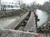
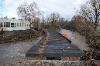
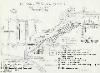
| Photos of the plans of the new grade crossing. Red lines indicate the old OPR yard track, which is now gone. Black rail lines, indicate the new OPR mainline and yard track in this particular area, which is now built. The rest of the plans show the planned combination, MAX/Trolley stop - OPR interlocking plant at grade crossing. Below photos show the crossing under construction. |


| Photos from 2005 |
| Ivon Street Crossing & Former Industrial Track PEPCo MP prior to 1955: X.XX - PTRD MP after 1955 (FRA): 0.61 - OPR Current MP: 0.49 |


| A view of the tracks going under the Ross Island Bridge, north bound. The curving bridge was the artery section added in the early 1960s, the second bridge is the main bridge constructed in 1926. |
| Ross Island Sand & Gravel Boat Ramp Vehicle Crossing PEPCo MP prior to 1955: X.XX - PTRD MP after 1955 (FRA): 1.46 - OPR Current MP: 1.34 |
| Just south of the Ross Island Sand & Gravel Spur is a boat ramp driveway crossing. This is a private crossing used only by Ross Island company vehicles and equipment to load their equipment onto barges and ship across the Willamette River channel to their operations on Ross Island. |
| Ross Island Sand & Gravel Spur Boat House Pedestrian Crossing PEPCo MP prior to 1955: X.XX - PTRD MP after 1955 (FRA): 1.59 - OPR Current MP: 1.47 |
| Just south of the Ross Island boat ramp is a pedestrian crossing that allows employees to access a boat house just south of their boat ramp. This pedestrian crossing is private and used only by Ross Island employees. |
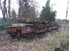
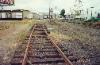
| Photos of the Ross Island Spur looking south bound. The spur is in poor condition and is no longer suitable for heavy car storage or interchange. It's currently only used for MoW storage. While only a car length or so is visible, it does continue for another several hundred feet onto Ross Island's property, but is covered in brush. 2012 photos. |
| Photo 1: Looking south bound. Photo 2: Looking west at the boat ramp as the crossing leaves the OPR west bound. Photo 3: Looking at the crossing north bound. 2012 photos |
| Photo 1: Looking south bound. Photo 2: Looking north bound. Photo 3: Looking at the Ross Island Boat House roof as visible from the OPR, south bound. 2012 photos |


| This Greg Brown photo was taken in 1993 and shows the No. 100 pulling several cars around the Holgate Curve southbound. This photo was taken prior to the construction of the Springwater trail in 2003 and shows the original west side track in service with the east side track long ago pulled up and just a gravel right of way. Today, the westside track is now the paved trail, while the track was moved over back to the east side row. |
| Southbound photos of the Holgate Curve. 2012 photos |

| Left: Aerial view of North Bridge. Right: Southbound photos of the North Bridge 2012 photos |
| The Oaks Spur PEPCo MP prior to 1955: X.XX - PTRD MP after 1955 (FRA): 3.03 - OPR Current MP: 2.91 |
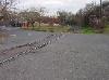
| The Oaks Spur is located just north of The Oaks Station and is part of The Oaks Station limits. The spur was constructed in the early 2000s when the Springwater trail was constructed on the western right of way and the OPR track moved back to the eastern right of way. The spur is track that was moved and continues to occupy the western right of way. The trail was built around the spur and includes two pathways that lead down to the Oaks Park parking lot. The spur was originally constructed to store MoW equipment on part of the track easily accessible by vehicle, while keeping the mainline open and is approximately 300 feet long. It's since been an invaluable assett during OPR public events and is a regular Saturday stop for our public train operations. |
| Left: Aerial view of the Oaks Spur. Next two: Southbound photos of the Oaks Spur. Last two: OPR 1413 southbound pulling into the Oaks Spur to allow another train to pass. 2012 photos |


| First three photos: Southbound photos of South Bridge. Next photo: Northbound photo of South Bridge. Last photo, taken of South Bridge at ground level below the tracks. 2012 photos |


| Left: Aerial shot of the Sellwood Bridge over the OPR tracks. Middle: Northbound photos of the Sellwood Bridge underpass, 2012. Right: Soundbound view of Sellwood Bridge in 2008. |


| On left is an aerial view of the Division St. Crossing. Right is a photo of the remains of the Inman-Poulson Lumber Mill spur shown in a recent aerial view. |


| Brian R Sopke photos taken in 1998 of "The Oaks" Station. The left photo is looking north, the right photo is looking south. What's interesting about these photos is how different things look today. Here you can see the mainline and the abandoned grade next to it that existed as a second set of rails when this line was double track. Today, a paved bike path exists where the tracks are in these photos, and the mainline moved over to the abandoned gravel grade shown in these photos. |

| First two photos taken in 2008, show a passenger special train at Oaks Station. Next photo taken in 2011, shows a freight train at the station. Last photo taken in 2012 shows another passenger special at the station. |


| These two photos are Brian R Sopke photos taken of the crossing at Spokane Street in 1998, prior to the new crossing panel replacement. Note the former Samtrak station located here. The left photo looking north, the right photo looking south. |

| Left Spokane Street crossing in 2008, looking south (note the Sellwood bridge south of the crossing) and then looking north towards Oaks Park. |

| This historical photo (on left) was taken sometime in the early 1950s, looking north from the Sellwood bridge at the Spokane Street crossing. Note the double track, trolley car and a spur taking off to an industry to the left. Also the former passenger station shed on the right that appears to be abandoned and probably not in service. The right photo is a more recent photo taken in 2011 that shows the same view and changes as of today. |
| The first two photos are Umatilla Street looking north and then south in 2008. The next three photos show the crossing construction and replacement that occured in 2008. |


| During the winter of 2008, the OPR agreed to relocate its track several feet over in conjunction with the City of Portland's big sewer pipe project. This involved relocating the track from several inches to several feet and also redoing several crossings. 2 Left pictures are the Harney Street Area looking southeast, showing the track before and after it was shifted over in this area by several feet. The next four photos show the crossing panels being installed in the spring of 2008. |


| This photo shows Harney St. taken sometime in the early 1950s with a trolley operating. The white house on the left is still there today. This is no obvious passenger station shed, so we don't know if one ever existed here or if this photo dates after it was torn down or if its out of the photographer's view. But time tables do indicate this was once a stop. |
| The Marion street crossing looking north. Left photo taken in 2008, right photo taken in 2005. |

| Spokane St. looking south in 2012 |

| Sellwood Bridge Pedestrian Crossing (Historical) PEPCo MP prior to 1955: X.XX - PTRD MP after 1955 (FRA): 3.63 - OPR Current MP: 3.51 |
| Just prior to the Sellwood bridge is a former public pedestrian crossing. This unprotected crossing allowed access from the Springwater trail to a set a stairs that climbs to the eastern approach to the Sellwood bridge. It no longer exists as the new Sellwood bridge no longer incorporate these stairs. |
| Remains of the Inman-Poulson Lumber Mill Spur still in place, but now isolated from the main, on private industrial property as viewed in 2012. |


| The north (left) and south (right) sides of the Ross Island Bridge as viewed from the OPR railroad tracks. |

| Far left photo taken in the late 1980s when the PTC was still operating and using SP locomotives. Next photo photos: The last hint of the industrial spurs around Ivon St. still poking out of the pavement. This spur left the east mainline approximately where the Springwater trail begins today and ran along side several buildings with loading docks along the street. |


| These photos were taken in 2005 when the old abandoned spur leaving the OPR could still be seen. Today it's since been paved over. Picture on the left is looking west. On the right is looking east. |


| Brian R Sopke photos taken while he was a conductor for Samtrak. These photos were taken at Sellwood station, which was located at the 9th and Linn Street crossings, when Samtrak was in operation. Brian R Sopke photos, 2000, 2001 |

| View of this crossing, looking south and then north and then north again from an OPR locomotive. These photos were taken in 2008 prior to the new crossing being installed in the fall of 2011 with new concrete panels. |


| 2012 photos showing the crossing today. From left to right: Looking south - Looking south from the south end of the crossing. (The OPR owns the property on the left that current has ties stored on it). - Looking north. |


| Marion St. crossing, left photo looking north, right photo looking south, photos taken in 2011. |
| 2012 photos showing the crossing today. Left photo looking south, right photo looking north. |
| 2012 photos showing the crossover still under construction. This project is currently on the back burner as other projects take precedence. |

| 13th Street Crossing is another unprotected crossing on the OPR�s East Portland Division. It gets significant traffic as a neighborhood city through street that connects several Sellwood area neighborhoods. The OPR rebuilt this crossing with all new track and concrete crossing panels and it�s much safer for motorists and trains alike. When rebuilt, the OPR added a second crossing panel track as future plans include rebuilding the former siding that existed here between 13th and Linn Streets. |
| 2012 photos showing the crossing. Left photo is looking south, right photo is looking north. |


| 2012 photos of the spur from the switch to the end. It's approximately 300 feet long. |


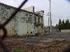
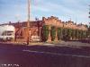
| The sad remains of the huge car barn constructed around 1902, with the substation in the background. The car barn was converted into a plastics factory at some point and used as such until 2002. The building and property were then sold off and ultimately sold to a developer who knocked down the structure and built condos there. |


| Photos on the left were taken in 2005 of the former OWP&Ry Co. electrical substation was built by the Oregon Water Power & Railway Company in 1905. It's original purpose was to provide power for the electrical railroads that ran through this area until the 1950s. More information can be found on our Portland Traction Co. History Page. Photos on right were taken in 2009 and show the substation with an OPR train running through the area. Far right photo taken in the same area in 1942, showing a PEPCo Freight with electric motors running over this line. Golf Junction during the OWP & Ry days. The substation in the background still exists. The line that the trolleys are sitting on is the OPR's East Portland Branch. And the line in the foreground is the Oregon City Branch, of which only this track shown, a couple of car lengths, still exists. A view of Golf Links station, later called Golf Junction, date unknown, but probably the early years. One more historical Golf Junction photo, date unknown. |

| These aerial photos show a major change that took place on the OPR East Portland line only a few years ago. On the left are sat photos taken sometime prior to 2003. In these photos we see the old car barn that was later converted into a molded container factory. This factory was a shipper on the OPR. However, by 2003, the factory had shut down and the historical building was torn down. In the photos on the right, we see what became of the carbarn. The building was completely razed except for one wall on the east side. Today, the property has condos or apartments with the remaining wall being integrated into the new development. In these photos you can also see the historical substation building show in the above ground photos. |


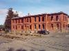
| The former Portland Traction Company car barn. These photos were taken by Brian R Sopke from the ground in 2000 while he worked as a conductor on Mr. Samuel's Samtrak passenger train. Today, nothing of this structure exists. The last wall which was planned to remain as condo decoration was torn down in early 2012. The picture on the far right is Motorman's clubhouse, probably also built between 1892-1901. In this picture it appeared abandoned in 2000. The building still exists today and was converted into apartments. Brian R Sopke photos, 2000 |


| In early 2007, the OPR was forced to build an enclosed fenced in area at Golf Junction to protect its property. The DR Horton Company built the condos that you see in these pictures. During construction, they appear to have told prospective buyers that the railroad was abandoned and would be going away. In addition, DR Horton construction crews ripped out approximately 50 feet of OPR railroad track without OPR's knowledge or permission. This resulted in legal action by the OPR and having to put up this fence to protect its remaining track. Photos taken 2007. |
| Photos of the 11th street crossing. Looking south and then north taken in 2008. This is prior to the new concrete panels being installed. |


| From left to right, the 13th street crossing looking north, then west, then east. These photos were taken right after a brand new crossing was installed in the spring of 2011 with brand new concrete panels. Photos: 2011 |

| Photos of the spur taken in 2005 showing an old flatcar being stored here at that time. |

| Oregon Rail Heritage Center Industrial Spur Interchange PEPCo MP prior to 1955: X.XX - PTRD MP after 1955 (FRA): X.XX - OPR Current MP: X.XX |
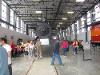
| The Oregon Rail Heritage Foundation, Heritage Center is the only industrial interchange in the OPR yard. Here the ORHF facility interchanges with the OPR, before reaching the UP mainline. The OPR interchanges all traffic in and out of the ORHF complex. The ORHF complex was constructed in 2012 and includes an engine house and museum that houses 3 historical steam locomotives owned by the City of Portland, including the SP 4449, SP&S 700 and O&RN 197. The ORHF Complex includes a public museum. Rail cars are regularly interchanged out of the complex to be leased to private operators or moved in and out of the OPR yard, where they are occasionally leased storage space. For more information about ORHF, visit their website. |


| Photos from mid 2012 showing the new ORHF facility towards the end of its construction with the steam engines now inside and the new industrial OPR/ORHF interchange being used for the first time (for left photos). |


| Looking west down the grade from 17th street towards 13th in 2008. The old double track siding remains are on the right. Mainline on the left. |

| The first three photos are of a northbound train of empties heading from Milwaukie to East Portland in the historic cut between 17th and 13th Sts in early 2010. The next two photos were taken in 2009 and show an extremely rare double header on the line in 2009. Photo on the far right was taken by Brian Sopke in 1998. This is looking south towards 17th street. |


| The 17th street crossing as seen in 2008. Picture on the left is looking east. Picture on right is looking west. |


| Richard Samuels photo from the 1960s, shows the No. 100 coming up the steep hill out of the AmeriCold Spur and headed for the 17th street crossing, which is just behind the photographer. |


| Heleco spur photos from 2008 and 2009., from left to right.... (1) Looking north as the spur departs the mainline and heads south (2 & 3) Looking south down the spur. (4 & 5) Looking at the end of the spur from 17th street. (6) 1202 switching cars out in this spur |

| Heleco spur photos from 2008 The spur leaves the mainline just west of the 17th street crossing and heads south (left in this pictures) |
| A train of empty cars being removed from the Helico spur and taken south towards the OPR shops in 2010, from left to right.... (1 & 2) Heading south on the Helico spur (4 - 6) Train switching from the Helico spur to the mainline/OPR shop spur. |


| First 4 photos show the Helico switch being replaced by the OPR in 2003 as part of the Helico crossing replacement project. The last two photos were taken by Mr. Samuels sometime in the early 1960s approximately, show Portland Traction Company crews switching out cars on this same spur in the early days. |
| Milwaukie Industrial Park (formerly Kellogg Industrial Park) |
| The Milwaukie Industrial district essentially consists of three south running spurs off of the East Portland line. The shops are located at the beginning of the center spur. The center spur runs south right along side SE McBrod Ave and is a little more than 1/2 mile long, ending at the intersection of SE McBrod Ave and SE 17th St. This spur is regularly used by the OPR for setting up trains to be taken to East Portland. Parts of the spur are also an excellent place for the OPR to store cars, out of service engines and other equipment as its shops and small yard are normally filled up with more regularly used equipment. The other two spurs service businesses in the district and are regularly used to ship railroad traffic. The industrial park was originally constructed in the late 1950s on old World War Two war housing property that was vacated. The Portland Traction Company and its parent company purchased the property with the intent of subdividing it and attracting new rail customers who would come in and ship by rail. At the time it was called Kellogg Park. A term largely lost to time as the industrial park is no longer unified under any single ownership. It's largely segregated among several owners, some of whom have allowed much non-rail utilized commercial and public infrastructure to be built in the area. |
| Overhead map showing the main spurs of the Milwaukie Industrial park. The far left spur is known as the Heleco Spur, the middle spur is known as the McBrod Ave Spur and the spur on the far right is known as the AmeriCold Spur. |


| Views of the other half of the spur inside AmeriCold from the locomotive taken in 2008. (3 on left) and on the ground (3 on right) |
| Photos of the first half of the AmeriCold Spur taken in 2008. From left to right... (1) Looking west as the AmeriCold spur (right) splits from the McBrod Spur (left) (2) Looking east, the AmeriCold spur on the left (3) Looking east, the AmeriCold spur approaches the McBrod Ave crossing. (4) Looking west, the AmeriCold spur crosses McBrod Ave. (5) Looking west, west of the McBrod Crossing. (6) The spur crosses Johnson Creek just west of the McBrod Crossing, looking west. |


| Photos of the first half of the AmeriCold Spur Johnson Creek Spur Rebuild in the Spring, 2011. Many more photos can be found here. The Johnson Creek bridge was originally built in 1954 as a 127 foot long open deck trestle with a 12 degree curve to the west. The ties and stringers were replaced in 1978, but by 2011, the ties and rail were desperate need of replacement and upgrade. In March, 2011, the entire upper deck, ties and rail were replaced. The rail was replaced with fully welded rail as well. All work done by OPR crews, as is usually case with most track work on the OPR. |
| This photo taken by Richard Samuels in the 1970s shows the OLCC spur which used to take off from the AmeriCold Spur just south of the bridge and entered a covered unloading area of the OLCC building. Shipments of liquior used to be brought in by rail. But in later years, the OLCC would recieve all shipments by truck and this spur and track was removed. |


| Aerial view of the OPR shops looking south |
| Aerial view of the OPR shops looking east |
| Aerial view of the OPR shops looking west |

| Aerial view of the OPR shops looking north |


| These photos were taken in 2008, but the only the equipment stored there has changed. The track arrangement and shop buildings is largely the same as today. This property was purchased by Mr. Samuels in the 1970s when we purchased the property to build his new steel fabrication facility that was located behind the current OPR shops. |
| Left photos show the shops in 2005. The orange caboose, which has since been moved, is shown where it was parked since 1991, utilized as an office for Mr. Samuels in the early years of the EPTC and OPR. Middle photos, show the shop property in the late 1970s verses 2005. In the 1970s, Mr. Samuels was utilizing this property for storage and preparing to build his steel fabrication shop, which would be located behind where the current shop building is today. The last photo taken in 1987 shows the recently aquired No. 100 freshly restored at Mr. Samuels Steel Fab Shop. Today, he no longer owns the building in this photo having located to the property in the foreground and behind the photographer. |
| Photos of the former Samuels Steel Products building being constructed on the property behind the existing OPR shop property. Mr. Samuels also aquired the current OPR shop property at the same time and built spurs into this property where he would store equipment, including smaller locomotives that he purchased at that time. |


| These photos were taken in 2011 and show the main OPR shop and office building. This building was built in 1996 and contains office space and the main shops. A one engine stall exists that is just big enough to allow any of the switchers or MoW equipment to be brought inside and worked on. Photos on the right give a description of the basic layout of the shop yard. |
| The 802 switching cars in the Milwaukie industrial park along McBrod Street in 2005. These other photos from 2005 show some of the equipment that used to be stored towards the end of the spur (some of it is still there today). The 1010 slug shown in the photo was later sold. |


| Photos of the McBrod Ave spur taken in 2008, from left to right.... (1) siding off the McBrod Ave spur about half way between the shops and the end of the spur (2) Looking south at another siding into loading docks one of the buildings. (3) Yet another siding and loading docks (4) The white box car is near the end of the spur. It's been there for years as a buffer car. (5) the brown box car behind the before mentioned white box car marks the very end of the spur. |


| Richard Samuels Photos taken in the mid 1980s shows the Portland Traction Company switching McBrod Ave in it's final years. By this time, the No. 100 and 200 had been sold off and the PTC was using SW1500s borrowed from the Southern Pacific Railroad. |
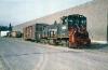


| Richard Samuels photos taken in the mid 1980s show the PTC No. 200 on its last operational run with the PTC before it was sold off. Shown here switching the McBrod Spur. |


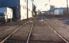
| These photos were taken in the final years of the Portland Traction Company in the late 1980s showing Caruthers Street Crossing at that time. Left photo is looking south from the crossing. Right photo is looking south from the south end of the East Portland Railyard. |


| This photo taken in the late 1980s, shows where the double track came down to a single mainline, just south of Ivon St. Today, the Springwater trail is where the track is show in the photo, with the current mainline to the right where the gravel right of way is. |
| Photos of the Holegate curve in 2002 just prior to the Springwater Trail opening. In this photo, the RoW has been shifted to the east and the new trail is now ready to be paved over. This is looking north. |


| Photos taken in the late 1980s, showing the Portland Traction Company operating a Southern Pacific engine south bound through Holegate Curve. |


| Photo taken in the 1980s looking north at the south end of Holegate Curve. |
| Photos taken in 1991 showing the line around the current Oaks Station. These are looking north. From left to right: Looking north at the last City of Portland owned Steam Locomotive on display in Oaks Park, the O&RN No. 197. This is approximately where Oaks Station is today. Last photo is looking north along the RoW just north of Oaks Amusement Park. The road on the left is the access road to house boats that are located on the Willamette River. |
| These photos were taken in the late 1980s when the line was still operated by the Portland Traction Co, using Southern Pacific engines. Looking north at Spokane Street from the Sellwood Bridge. |
| In 2002, OPR crews added crossing panels to this crossing. 6 years later, the crossing would have to be removed and shifted over several feet to accommodate a Portland Pipe project and would later accommodate an extension of the Springwater trail. |


| Photos taken in the late 1980s showing the Boring Branch still in service in the background with the Helico Spur in the foreground at that time. |
| These photos taken around the early 1990s show the No. 100 and 5100 as they switch cars out along the side of the OLCC building, southbound on the spur. |


| Photos from September 23, 2012 during the grand opening of the Oregon Rail Heritage Center. |


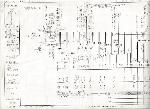
| Track diagram sketches drawn in 1981 by Craig Bass of the East Portland yards at that time. A lot of changes have taken place since then. http://craigsrailroadpages.com |

| Track diagram sketches drawn in 1981 by Craig Bass of Golf Junction at that time. A lot of changes have taken place since then. http://craigsrailroadpages.com |
| Track diagram sketches drawn in 1981 by Craig Bass of the Milwaukie Industrial Park at that time. A lot of changes have taken place since then. http://craigsrailroadpages.com |
| This photo taken at Caruthers in 1993 looking northeast, shows the OPR's Samtrak train southbound along the then existing double track and an SP Switcher waiting to cross over the OPR's tracks. The SP spur was abandoned and paved over a few years later. |

| This photo taken in early 2013 shows the now closed spur with the gate shut and sealing off the spur to rail traffic for now. No more rail customers remain, but the tracks will remain in place in the hopes that another rail customer will soon make use of them. |
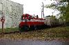
| OPR 5100 Roster Page No. 5100 is a former Southern Pacific GE 70 tonner. This engine was modified with a Detroit Diesel V-12 making 450 h.p. It is expected to return to service after repairs are completed. |

| UnNamed Log Dump (historical) PEPCo MP prior to 1955: X.XX - PTRD MP after 1955 (FRA): X.XX - OPR Current MP: X.XX |
| Just south of Holgate Moorage was perhaps the largest original log dump on the railroad. It was located in the middle of the Holegate Curve to allow for dumping logs into the Holegate Slough. The log dump track took off from the PTC at the north end of the Holegate Curve, cutting a straight line through the curve and connecting back again with the line at the south end of the Holegate Curve. In the middle of this 2961 foot track was a wood pile trestle log dump. This history of this dump is a little unclear, but we know that the Portland Traction Company took ownership of it from PGE in 1953. At some point in the early 1950s when the first trolley cars were burned and scrapped, they were scrapped on the south leg of this log dump. The tracks and spur were scrapped around 1962. Floods of 1964 largely finished the job, wiping out part of the log dump fill and probably wiped out whatever was left of the log dump trestle. Today, the property is all owned by Portland Parks and is part of the Springwater trail, with a dirt foot trail existing where the spur once was. It can still be seen as the spur was built up on a fill that remains today. |